Gorkha Budhigandaki Floods and Landslides: Flash Flood Effects
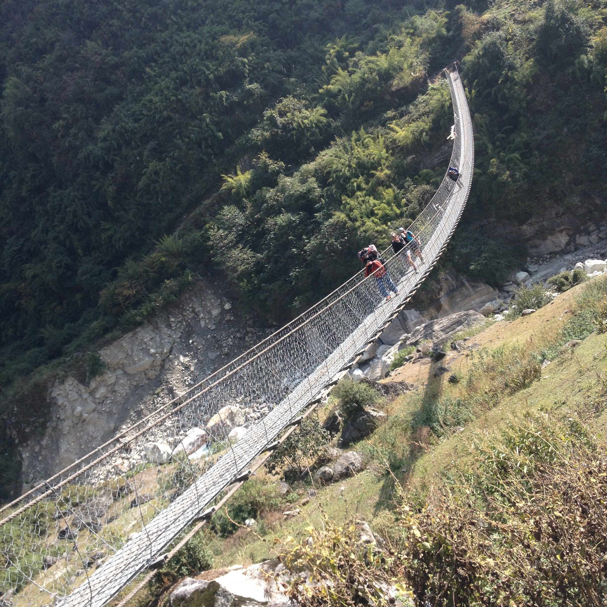
Gorkha Budhigandaki Floods and Landslides: Flash Flood Effects and Travel Update
A landslide-triggered Budhigandaki flash flood struck northern Gorkha before dawn on 11 October 2026. The surge raced down the Budhi Gandaki valley, which carries the Manaslu Circuit and Tsum Valley trekking routes. It destroyed bridges, damaged riverside villages and left more than 100 foreign trekkers stranded during the busiest part of the autumn season.
Gorkha district lies about 100 km west of Kathmandu, and the Budhi Gandaki is a tributary of the Trishuli River. This update explains what happened, what was damaged, and how rescue and road repairs are progressing. It also tells travelers what to do next. All figures come from official statements and national media reports published up to 13 October 2026, and some numbers are still changing.
Budhigandaki Flash Flood at a Glance
The table below summarizes the key entities and attributes of the event, based on the Gorkha district reports and national disaster authority figures.
Event
Landslide-triggered flash flood on the Budhi Gandaki River
Date and time
11 October 2026, around 4:00 am (district office informed at 4:35 am)
Location
Gorkha district, Gandaki Province, Nepal
Point of origin
Chumnubri Rural Municipality, ward 6, near Chumchet
Probable trigger
Failure of a temporary landslide blockage; cause under investigation
People missing
Five residents of Ungilung, Chumchet
People rescued
About 95 to 96, including nine foreign nationals, by four Nepal Army helicopters
Foreign trekkers stranded
More than 100, mainly around Jagat (initial count)
Bridges lost
Six, including two motorable and four suspension bridges (counts vary)
Hydropower projects hit
Three: Yaru Khola, Machhakhola and Dobhan
Manaslu Circuit status
No reopening date announced
Landslide Dam Failure Behind the Budhigandaki Flash Flood
Authorities say a dry landslide in Chumnubri blocked the river and led to the downstream flood. Residents suspect that the Syar stream, a tributary between Lokpa and Chumling, was dammed first. The International Centre for Integrated Mountain Development (ICIMOD) said preliminary accounts point to the failure of a temporary blockage.
A landslide dam forms when debris plugs a narrow gorge and water pools behind it. When the plug gives way, a debris-laden surge rushes downstream with little warning. That pattern explains the mud, boulders and black sludge reported in Arughat Bazaar after the water receded.
The government has sent technical teams to study the origin of the flood and the surrounding geology. Investigators have not yet published a final cause. Until they do, travellers should treat every steep valley in the region as unstable after heavy rain.
Timeline of the Flood from Chumchet to Arughat
The flood moved fast, but early alerts gave downstream communities some time to react. The sequence below combines district, municipal and disaster authority accounts.
• About 4:00 am: Residents of Chumchet hear a rumbling sound as the surge begins in Chumnubri-6.
• 4:35 am: Gorkha's Chief District Officer, Dharmendra Kumar Mishra, receives word of a major flood.
• 6:40 am: The National Disaster Risk Reduction and Management Authority (NDRRMA) sends an SMS warning to stay on high ground.
• About 7:30 am: The Soti bridge is washed away, according to the Arughat Rural Municipality chair.
• About 10:00 am: A second bridge in the lower Arughat area is hit.
• By evening: Helicopters and ground teams have rescued 95 people.
Local leaders credit the early alerts for preventing deaths in the Arughat area. Upstream, however, five villagers from Ungilung remain missing.
Damage to Settlements, Bridges, and Hydropower Projects
Early district counts reported about 35 houses swept away. Later national disaster authority figures cited by Al Jazeera put the loss at more than 200 homes. The difference reflects incomplete damage assessments in remote wards. Salleri, Paiyuka and the Jagat riverbed were among the affected areas.
Infrastructure losses extend well beyond housing. The disaster authority reported damage to two telephone towers and 50 electricity poles. Three hydropower projects were also hit: the 30.59 MW Yaru Khola project lost a Bailey bridge and equipment, the 16 MW Machhakhola project lost access roads and a bridge, and the 24.5 MW Dobhan project suffered camp and bridge damage.
Arughat's local government reported that hospitals, schools and ward offices were not damaged. A drinking water pipeline, however, needs repair, and residents are still waiting for a full damage assessment.
Helicopter Rescue and Stranded Trekkers near Jagat
Jagat, in Chumnubri-3, is the gateway to the Manaslu Conservation Area. According to the Manaslu Conservation Area Project (MCAP), 98 foreign tourists entered the area on Saturday, and others reached Jagat that night. Another 17 tourists waited in Lokpa and about 40 in Chhekampar.
The Nepal Army deployed four helicopters, including an MI-17, for rescue and relief. By Sunday evening, 95 people had been evacuated, and the operation continued on Monday. One stranded trekker told Anadolu that electricity and communications were down and food supplies were running short.
MCAP official Bhuwan Raj Ojha said trekkers who wish to return need rescue, while those who wish to continue may do so only from safe locations. MCAP has also advised trekkers to suspend journeys into the Tsum Valley.
Road and Bridge Repair Progress Between Arughat, Soti and Gorkha
Road recovery is the main concern for both residents and tourism operators. The Arughat bridge, which joins Gorkha and Dhading, lost a 22-metre section on the Gorkha side, and traffic has been halted since Sunday. The Kathmandu Post reported that Bailey bridge materials from Hetauda reached Arughat via Gorkha Bazar on Tuesday, 13 October.
A Nepal Army technical team is already on site with the Gorkha Road Project. Project chief Binod Pun said the damaged section must be concreted first, and the team aims to finish the Bailey bridge within ten days. That target points to late October, although weather and ground conditions may change it.
Crossing
Connects
Current status
Arughat bridge
Gorkha and Dhading
22 m section lost; Bailey bridge being prepared by the Nepal Army
Soti bridge
Soti and Manbu, Arughat Rural Municipality
Destroyed; no restoration timeline announced
Cantilever bridge near Jagat
Jagat and Salleri
Destroyed; ground movement cut off
Dharche Bailey bridge
Dharche wards 1 and 3
Swept away; assessment ongoing
The Department of Roads and the Department of Local Infrastructure are also assessing temporary Bailey bridges for other crossings. Meanwhile, the Home Minister said free public bus service from Arughat to Gorkha would begin soon, and three trucks carried the first relief supplies. The Arughat chair has used an excavator to clear silt near Ajuwa Khola in Soti.
Manaslu Circuit and Tsum Valley Trekking Status
The Manaslu Circuit runs near Nepal's border with China, and October is one of its busiest months. Every trekker must pass through the lower Budhi Gandaki valley, which is exactly where the damage occurred. As of the latest reports, no reopening date has been announced.
Several trekking operators are treating both the Manaslu Circuit and the Tsum Valley as closed to new departures until MCAP or the Gorkha District Administration Office issues an assessment. Travellers with bookings should read our Manaslu Circuit trek guide and contact their operator before departing Kathmandu.
Repeated Himalayan River Hazards in the 2026 Monsoon Season
This flood is not an isolated event. In August, a glacier collapse on another Trishuli tributary caused a flood that killed 1,457 people, with thousands still missing at the time of reporting. Trekking operators also report a 6 September flood at Namrung that closed the Manaslu Circuit, and a 27 September Marsyangdi flood and avalanche that disrupted Manang's road, power and telecom.
ICIMOD stresses that understanding what triggered each flood is critical for reducing future risk. For visitors, the lesson is practical. Mountain valleys in Nepal can change quickly after monsoon rain, so flexible itineraries and current local information matter more than ever.
Safety Guidance for Foreign Travellers Visiting Gorkha
Foreign visitors can reduce risk by planning carefully and checking sources often. The following steps apply to anyone heading toward Gorkha, Arughat or the Manaslu region:
• Confirm route status with a registered trekking agency and the Trekking Agencies' Association of Nepal (TAAN).
• Postpone Manaslu Circuit and Tsum Valley trips until MCAP or the district administration confirms safe access.
• Buy travel insurance for Nepal that covers helicopter evacuation and trip interruption.
• Check trekking permit rules again if you change your route, since permits are region specific.
• Keep several spare days in your itinerary and carry enough cash for delays.
• Stay away from riverbanks and follow NDRRMA alerts and local police instructions.
Travel Safety FAQs
Is the Manaslu Circuit open right now?
No reopening date has been announced. The lower trail and several bridges were damaged, so operators are not sending new groups.
Can vehicles cross the Arughat bridge?
Not yet. A 22-metre section was washed away, and the Nepal Army is preparing a temporary Bailey bridge.
Are other trekking regions affected by this flood?
The flood was confined to the Budhi Gandaki corridor. Manang, however, is still recovering from a separate flood, so check each region individually.
Should I cancel a booked trip to Gorkha?
Speak with your operator first. Many can reschedule or reroute, and your insurance terms may cover cancellation or delay.
Outlook for Gorkha Tourism Recovery
Gorkha's recovery will depend on three things: restored road links at Arughat and Soti, rebuilt trail bridges toward Jagat, and a clear safety assessment of the landslide site. Rescue efforts were rapid, and the Bailey bridge plan gives the lower valley a realistic path to reconnection within weeks.
Authors note: this article draws on reporting from the Kathmandu Post, OnlineKhabar, myRepublica, Rising Nepal, Al Jazeera and Reuters. It was last updated on 15 October 2026. Please check the NDRRMA and MCAP for the latest status before you travel.

Leave a Reply
Your email address will not be published.